Spaceship Earth viewed through Marble
By EricMesa
- 7 minutes read - 1417 wordsRecently I was listening to a Talk of the Nation interview with Jerry Brotton about his new book A History of the World in Twelve Maps. He mentions how the maps have a political reason for existing as well as having an effect on the viewer. He also mentioned how the map creator always puts him or herself in the center. Interestingly, I learned that for most of human history it has not been governments who have created maps, but corporations (such as the Dutch East India Company) who needed maps for commerce. The last map he mentions in his book, which he worked on for seven years, is Google Earth. I haven’t read the book yet, but during the interview he mentioned that it was one of the first times we have a union between a globe and a map. Also, that through the “magic” of computer technology it’s an infinite map as you can always keep scrolling in any direction.
I remember when Google Earth got big. I was already into Linux so I went through the rigmarole of getting it to work on Linux. In actuality, it wasn’t much work although it wasn’t installed in the usual manner. I played with it for a few days, but I was already past the age of caring too much about geography. I would have loved Google Earth when I was in elementary school and I used to marvel at my globe and peruse atlases. It certainly would have been interesting to grab the update on the day the Soviet Union collapsed. Rather than have an out of date globe or map I’d have an up-to-date resource. Of course, that does go back into the whole political thing - when Google decides to show this or that disputed region as belonging to someone they are, in a sense, making a political statement. And they make another one - they tend to show country names as written in that country in addition to English.
Well, the program got me thinking. I haven’t had Google Earth installed on my Linux or Windows computers in years. However, on my Linux computer I do have the KDE equivalent: Marble. Given my renewed interest in geography via GPS tracking and given that Scarlett will probably be interested in the globe in a few years if for no other reason than to track where her family lives I decided to see if Marble was up to the task. I although thought it’d be interesting to see if it would be useful for planning a trip (not so much getting directions as getting a feel for the environment). When I went to a photography seminar at B&H a few years ago, the speaker mentioned using resources like Google Earth/maps, etc to get a feel for the location you’d be going and how far apart things really are. It could certainly make for better planning of an itinerary, so I’ll check out how well it works for that by testing some local places I know (like DC or Baltimore) and some places I’m likely to visit like San Francisco. As a final note in terms of procedure: I’m going to go into this blind. I’m aware that KDE programs tend to have very good documentation (although it does vary wildly depending on the program), but I’d like to see how well it’s designed/laid out for someone who’s comfortable with technology and exploring programs. That said, let’s take a look.
Here’s what I see when I start Marble for the first time on my computer:
[caption id=“attachment_5714” align=“aligncenter” width=“500”] 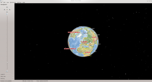 Marble default opening[/caption]
Given what I started above it could be that it starts up with Europe because of the Europe-centricity of the developers. Of course it makes just as much sense to suppose they’ve just set it to start at 0 degree north (hence the top) and 0 degrees east-west (hence Europe). Clicking the arrows appears to move you in the cardinal directions one degree at a time. (At least at this zoom setting)
[caption id=“attachment_5715” align=“aligncenter” width=“63”]  Marble Legend[/caption]
The legend gives you a pretty good idea of the incredible amount of information conveyed on the map. Populations, elevation, and capitals easily shown just by looking at colors. You can even turn off boundaries and just see the world as it truly looks.
[caption id=“attachment_5716” align=“aligncenter” width=“56”]  Marble Map View[/caption]
The map view lets you pick how you see the world. It also lets you choose a flat projection if you happen to need that. Here are a few screenshots:
[caption id=“attachment_5717” align=“aligncenter” width=“500”] 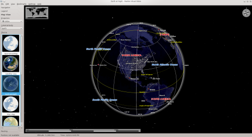 Marble Earth at Night View[/caption]
[caption id=“attachment_5718” align=“aligncenter” width=“500”] 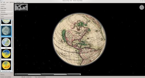 Marble Historical Map View[/caption]
[caption id=“attachment_5719” align=“aligncenter” width=“500”] 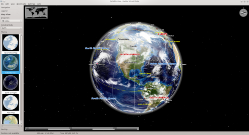 Marble Satellite View[/caption]
Here’s the open streetmap view of Baltimore, MD:
[caption id=“attachment_5720” align=“aligncenter” width=“500”] 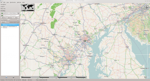 Marble Open Streetmap Baltimore, MD[/caption]
Here I’ve zoomed in a bit more and done a path calculation between two cities:
[caption id=“attachment_5721” align=“aligncenter” width=“500”] 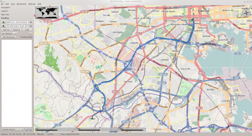 Marble Open Streetmap Baltimore, MD to Elkridge, MD[/caption]
I’m not quite sure where it is meant to show the driving directions. Like if I wanted to know how to get somewhere. Perhaps that feature’s not in Marble? That seems a bit odd, though. I mean if it’s going to plot the path it’d be nice if it told you what that path was. I was really hoping it could pull addresses from KDE’s address book, but that doesn’t appear to be possible. It’s also disappointing that it doesn’t appear you can overlay satellite AND open streetmap like you can with Google Earth. It also doesn’t have the zoomed in satellite imagery that Google does, rending it less useful for planning trips.
[caption id=“attachment_5722” align=“aligncenter” width=“500”] 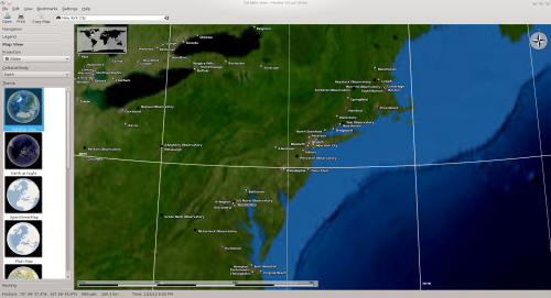 Marble Low Resolution Satellite Imagery[/caption]
I found this interesting feature when I clicked on a city:
[caption id=“attachment_5723” align=“aligncenter” width=“377”] 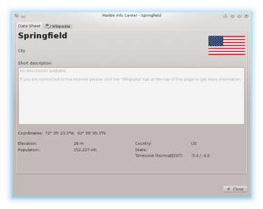 Marble Info Center[/caption]
Unfortunately, NYC was not any more populated. If you go to View-> Online Services -> Postal Codes you can see the zip codes. Unfortunately, it doesn’t seem to draw any boundaries for them.
[caption id=“attachment_5724” align=“aligncenter” width=“386”] 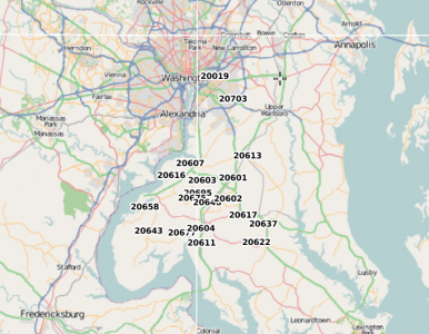 Marble Zip Codes[/caption]
Here I have turned on the satellite view in that same menu (online service). And ’m displaying the path and info for one of them.
[caption id=“attachment_5726” align=“aligncenter” width=“388”] 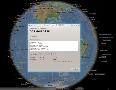 Marble Satellites[/caption]
I went online and via the File -> Download go a hiking map, a biking map, and a public transport map:
[caption id=“attachment_5727” align=“aligncenter” width=“472”] 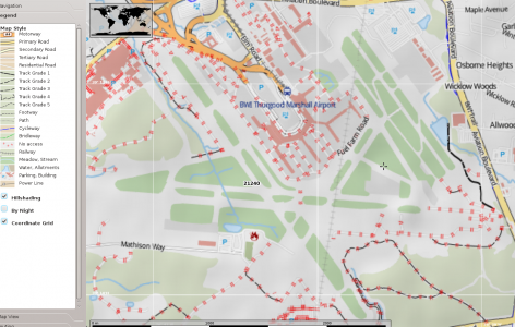 Marble BWI Trail, I think[/caption]
[caption id=“attachment_5728” align=“aligncenter” width=“500”] 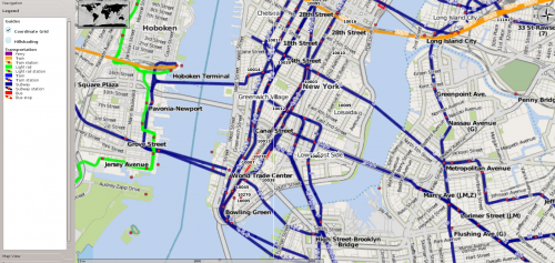 Marble New York City Subway[/caption]
The NYC transit map is well fill out, but there are two issues I have with it - one is an easy fix and one isn’t. The letters and numbers of the train lines could be a bit easier to read. That’s the easy fix. The hard fix is that by having one color for all subway lines, it ruins part of what makes a subway map quick to read. That’s exacerbated on the Washington, DC map where the lines are only identified by color.
[caption id=“attachment_5729” align=“aligncenter” width=“500”] 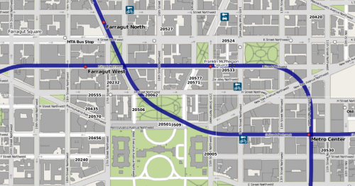 Marble Washington DC Subway[/caption]
I was able to type in Walt Disney World and it did find that. So score one for the developers there.
[caption id=“attachment_5730” align=“aligncenter” width=“392”] 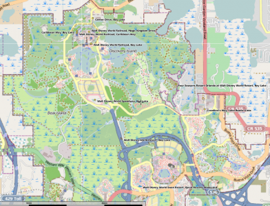 Marble Walt Disney World[/caption]
Here is my GPS track when I rode bike around the airport. It’s green. Unfortunately, I don’t know how to make it thicker so it’d be easier to see. At the very least embolden it.
[caption id=“attachment_5734” align=“aligncenter” width=“316”] 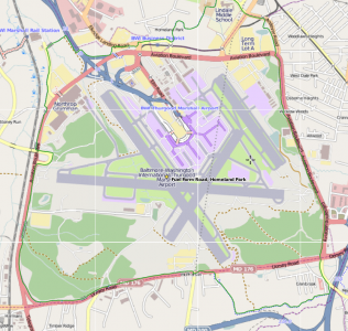 Marble Bike Trail GPX Import[/caption]
Let’s take a quick look at the moon!
[caption id=“attachment_5732” align=“aligncenter” width=“287”] 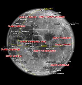 Marble The Moon[/caption]
So, in the end what do I think of Marble? In just a few words: I’m impressed but it needs some polish. Perhaps it’s because good GPS photos cost money and Marble will never catch up to Google Earth. Marble fits the bill perfectly for teaching my daughter about the world and to use for school projects that need an atlas or globe. But for doing research for a vacation - it just can’t match Google Earth and its high resolution photos that let you see beaches. The historical maps are awesome as are the maps of other planets and the view of the satellites orbiting Earth. So there’s some great work here, it’s just not there for certain applications. Not bad.for something completely done by volunteers!
(In case you’re wondering Spaceship Earth is a reference to a term used in the 1970s (I think) once we had the NASA photo of Earth hanging in space.)